Durn Development Plan - for Consultation
Durn Development Brief – Draft for consultation
August 2014
Mark Widdup, Director of Economy and Environment, Rochdale Borough Council
For information please contact:
Strategic Planning Team – strategic.planning@rochdale.gov.uk – 01706 924252
C o n t e n t s
Durn Development Brief – Draft for Consultation August 2014
Durn Development Brief Durn Development Brief Durn Development Brief Durn Development Brief Durn Development Brief Durn Development Brief Durn Development Brief Durn Development Brief Durn Development Brief Durn Development Brief Durn Development Brief Durn Development Brief Durn Development Brief Durn Development Brief Durn Development Brief Durn Development Brief Durn Development Brief Durn Development Brief Durn Development Brief Durn Development Brief Durn Development Brief Durn Development Brief Durn Development Brief – Draft for Draft for Draft for Draft for Draft for Draft for Draft for Draft for Draft for Draft for consultationconsultationconsultationconsultationconsultationconsultationconsultationconsultationconsultationconsultationconsulttionconsultation
August 2014
Contents
1 About the brief .................................................................................... 1
Purpose ...................................................................................... 1
Objectives ................................................................................... 1
2 Site Characteristics ............................................................................... 3
Site location and description ............................................................. 3
Access ........................................................................................ 4
Topography and ground conditions ...................................................... 4
Ownership ................................................................................... 5
3 Background to the site ........................................................................... 6
Previous proposals ......................................................................... 6
Issues to consider .......................................................................... 6
Planning policies ........................................................................... 7
4 Redevelopment of the site ..................................................................... 10
Proposed scheme and mix of uses ...................................................... 10
Proposed scheme and mix of uses ...................................................... 11
Design issues ............................................................................... 11
Specific canal related issues ............................................................. 12
Access arrangements ..................................................................... 13
5 Further work and recommendations .......................................................... 14
Site assembly .............................................................................. 14
Securing appropriate access ............................................................. 14
Viability issues ............................................................................. 14
Planning applications ..................................................................... 14
6 Appendix 1 – Local planning policy context .................................................. 16
Relevant UDP policies .................................................................... 16
C o n t e n t s
Durn Development Brief – Draft for Consultation August 2014
Relevant Supplementary Planning Documents ........................................ 17
Emerging Core Strategy Policies ........................................................ 18
7 Appendix 2 – Background and information relating to Rochdale Canal SSSI and Special Area of Conservation .................................................................................. 19
Figures
Figure 1 - Parcels of land forming site .............................................................. 3
Figure 2 – Historical map of site ...................................................................... 5
1 A b o u t t h e b r i e f
P a g e | 1
Durn Development Brief – Draft for Consultation August 2014
1 About the brief
1.1 This brief deals with an area of land straddling the Rochdale canal at Durn, Lttleborough. The site is formed by four distinctive parcels of land which combine to create a total site area of approximately 2.1 hectares.
1.2 This area has for a number of years been identified for potential redevelopment given its sustainable location and relationship with the re-opened Rochdale Canal. This culminated in the whole site being identified as an Area of Opportunity within the Unitary Development Plan (UDP) which was adopted in 2006.
1.3 Of the four parcels of land, two are in the ownership of the Council whilst the remaining two are in separate private ownerships. There is also another small area of land in private ownership which is part of the Area of Opportunity and adjoins one of the Council owned parcels of land.
1.4 The site provides an opportunity to deliver a high quality scheme which enhances the canal corridor and adds to the tourism and visitor economy.
Purpose
1.5 The purpose of this brief is to set out the potential redevelopment of this site in a linked and co-ordinated manner so to deliver a high quality scheme.
1.6 This development brief provides:
A background to the site
An overview of the known and potential site constraints
A summary of the planning context – including planning history and relevant planning policies
Options for the redevelopment of the site
An indication of the further work required to help to bring the site to the market
Objectives
To identify the key issues and set out clear recommendations to help bring the site forward to the market
To ensure that the scheme delivered is of a high quality and makes the most of its canal side location
1 A b o u t t h e b r i e f
P a g e | 2
Durn Development Brief – Draft for Consultation August 2014
Please note: All maps published in this development brief are subject to the following copyright information: © Crown copyright and database rights 2011 Ordnance Survey [100023108
2 S i t e C h a r a c t e r i s t i c s
P a g e | 3
Durn Development Brief – Draft for Consultation August 2014
2 Site Characteristics
Site location and description
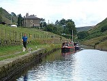
2.1 The site at Durn is located a relatively short distance to the north east of Littleborough town centre. The site is bisected by the Rochdale Canal which runs from north east to south west through the site and is bounded by the railway line to the west, Halifax Road to the south, dwellings fronting Halifax Road to the east and open land within the Green Belt to the north. The site comprises four distinct parcels of land. These can be seen on Figure 1 below.
Figure 1 - Parcels of land forming site
2 S i t e C h a r a c t e r i s t i c s
P a g e | 4
Durn Development Brief – Draft for Consultation August 2014
2.2 Site 1 was once occupied by Frankfort Mill and in more recent years was used as a scrapyard. The site was acquired for residential development by Brierstone properties and an application for the construction of 29 houses and 14 apartments was submitted in January 2010. Although members were minded to grant permission the decision was subject to a section 106 agreement which was never completed. The site has remained undeveloped.
2.3 Site 2 is predominantly within Council ownership. The small rectangular building in the south west corner of the site has recently been cleared. On the south east edge of the site is a small area of land within private ownership which is currently occupied by two small workshops. The rest of the site is vacant with the northern half covered by vegetation including small trees and bushes.
2.4 Site 3 is in private ownership and is currently occupied by Mechplant who are a plant hire firm.
2.5 Site 4 is in Council ownership and was the site of a former depot. There is a rectangular industrial building on the site which was used for storage. The rest of the site is vacant although there is some evidence of on-site storage.
Access
2.6 There are three principal access points into the site. Site 1 referred to above is accessed directly from Halifax Road. This access point was agreed for the planning permission that members were minded to grant for 43 dwellings.
2.7 There are two access points which currently serve sites 2, 3 and 4 both of which access onto Halifax Road. Shore Hill is adjacent to site 2 whilst Schofield Street is the principal access for sites 3 and 4. It is likely that at least one of these access points would have to be improved to adequately service a redeveloped site. More detail regarding the most appropriate solution is set out later in this brief.
Topography and ground conditions
2.8 The entire site is relatively flat making any redevelopment straightforward. Site 1 does sit slightly below the level of the canal but this is not so significant that it causes problems in terms of design or overlooking.
2.9 The whole area has been occupied by industrial uses in the past. This can be seen on Figure 2 overleaf.
2.10 The part of the site where contamination is most likely would be site 1 which was formerly occupied by Frankfort Mill but which had more recently been in use as a scrapyard. However, this site has recently been prepared for
2 S i t e C h a r a c t e r i s t i c s
P a g e | 5
Durn Development Brief – Draft for Consultation August 2014
residential development and therefore it can be assumed that this site has been satisfactorily remediated.
Figure 2 – Historical map of site
2.11 As can be seen on the plan part of site 2 was once occupied by an iron foundry and therefore there may be potential for some contamination. Sites 3 and 4 seem to have less potential for contamination but it is likely that a survey of the whole site may be required.
Ownership
2.12 As described in the section dealing with site location and description the site is in a mixture of Council and private ownerships.
2.13 Whilst some elements of a scheme could come forward independently (e.g. land to the west of the canal) there are clear advantages in bringing forward a cohesive scheme which brings the parcels of land together into one site. This would not only improve the design of the scheme but would enable issues such as access to be dealt with more sustainably.
3 B a c k g r o u n d t o t h e s i t e
P a g e | 6
Durn Development Brief – Draft for Consultation August 2014
3 Background to the site
Previous proposals
3.1 The site on land to the west of the canal was the subject of an application for 43 dwellings, made up of 29 houses and 14 apartments, which was submitted in January 2010. Although members were minded to grant permission this was subject to a Section 106 agreement which was never signed. Some works were carried out on the site in advance of the application being granted but these ceased and the site has remained vacant in the intervening period.
3.2 Subsequently discussions have taken place with the developers regarding this site and the site as a whole to bring forward a comprehensive scheme. However, although a draft layout was produced this has not progressed as far as a planning application.
3.3 None of the other parcels of land have been subject to planning applications for redevelopment.
Issues to consider
3.4 The Rochdale Canal which runs through the site provides a significant asset in terms of developing an attractive and successful scheme. In recent years sites which have a waterside outlook have been considered attractive by developers, both in terms of the quality of the scheme that can be provided and end values. However, it is important to note that the Rochdale Canal is a Site of Scientific Importance (SSSI) and is designated under the EC Habitats Directive as a Special Area of Conservation (SAC). These designations both relate to the fact that the canal supports a significant population of floating water-plantain which is a rare aquatic perennial plant which is considered to be a threatened / declining species. Consequently any redevelopment of the site would have to take account of this status and, if necessary, seek advice from Natural England in terms of any design implications.
3.5 In addition to these biodiversity considerations, redevelopment must also take into account the continued operation of the canal and its towpath. Appropriate access to the canal for any engineering works would be a likely requirement of the Canal and River Trust (formerly British Waterways) and again their input should be sought in developing a scheme for the site. The eastern bank of the canal contains a sanitary station for canal users and this would need to be retained or provided elsewhere on the site as part of any scheme. More detail regarding canal related uses is included in the section on planning policies.
3 B a c k g r o u n d t o t h e s i t e
P a g e | 7
Durn Development Brief – Draft for Consultation August 2014
3.6 The Calder Valley railway line runs along the western edge of the site and there will be some noise implications stemming from this. This issue would have been addressed as part of the application submitted for residential development on land to the west of the canal. However, consideration would also have to be given with regard to the rest of the site, particularly site 4 which is still relatively close to the track despite being on the other side of the canal.
3.7 The issue of contamination has been referred to previously in relation to topography and ground conditions. The types of uses previously located on the site would mean that an appropriate contamination survey would be required across the site.
Planning policies
3.8 This site is designated as an Area of Opportunity in the adopted Unitary Development Plan (UDP). Policy R/4 (b) specifically deals with this site and sets out the types of uses which are considered appropriate along with design and other issues which should be taken into account as part of any scheme. This policy is set out below:
R/4(b) DURN AREA OF OPPORTUNITY, LITTLEBOROUGH
This area is allocated for canal related leisure development and housing.
Development must include:-
a) Residential and visitor mooring facilities; and
b) Housing (primarily on land west of the Canal)
Acceptable uses in addition to (a) and (b) are:-
c) Boat hiring and maintenance;
d) Specialist retail (e.g. boats chandler) and other support facilities, and
e) Food and drink (A3) premises.
The principles for development are:-
i. New development should enhance the canal corridor and incorporate the canal as the key feature within the development, ensuring that public access to the canal is maintained and improved, and that the impact of development on the nature conservation value of the canal is taken fully into account;
ii. Measures should be incorporated to safeguard the amenity and safety of residents within or adjoining the site, and the visual amenity of adjacent Green Belt;
iii. Development proposals will be expected to incorporate off-site highway improvements, visitor parking controls and measures to make the site accessible and attractive to non- car visitors, and as informed by a transport assessment and travel plan; and
3 B a c k g r o u n d t o t h e s i t e
P a g e | 8
Durn Development Brief – Draft for Consultation August 2014
iv. Proposals must protect the nature conservation value of the Rochdale Canal.
3.9 The explanatory text for this policy provides some further guidance on the aspirations for this Area of Opportunity. This is covered in paragraph 12.18 of the UDP which states that:
Potential exists at Durn to create a mixed-use development to bring about environmental and economic benefits by promoting tourism, supporting town centre uses, enhancing the canal corridor and providing a quality housing environment. This site provides an ideal, and probably the only opportunity, to secure the provision of linear moorings or a mooring basin at the interface between the Pennine stretch of the canal and the urban area of Littleborough, adjoining the town centre and close to good rail and public transport links. A marina could be established with other boating, ancillary and support services and tourism uses that support canal traffic and visitors to the area. Specialist retail facilities would include retail services aimed at canal users and boat owners. Development would also help to complement local tourist attractions. …
3.10 This policy and its supporting text sets out the potential redevelopment of this site and also outlines the wider role that a high quality scheme could provide in improving the role and function of the canal and add to the tourism assets of the area.
3.11 Whilst policy R/4 (b) is the principal land use policy relating to this site, other UDP policies are likely to be relevant depending on the type of uses developed on the site. Policy LT/7 of the UDP relates specifically to the Rochdale Canal seeks to ensure that any new development does not adversely affect the physical and natural value of the canal whilst encouraging development which seeks to maintain and enhance these assets. Given the recent permission on the western part of the site and the fact that residential development is supported within policy R/4 (b) then policies dealing with affordable housing (H/7) and recreational open space in new housing development (H/6) are likely to be relevant to any proposals.
3.12 Whatever redevelopment options are to be taken forward, the general development management policies set out in the UDP will need to be taken into account e.g. policies dealing with design. More detail regarding the likely relevant planning policies and associated Supplementary Planning Documents (SPD’s) is set out in Appendix 1.
3.13 The UDP is due to be replaced by a Core Strategy and subsequent Allocations Development Plan Document. However, the policies in the UDP are ‘saved’ until replaced by these new Local Plan documents. The policies within the Core Strategy at present have limited weight given that it is yet to be adopted.
3 B a c k g r o u n d t o t h e s i t e
P a g e | 9
Durn Development Brief – Draft for Consultation August 2014
However, any proposal could helpfully demonstrate that it has considered emerging policies, such as those relating to design, in order ensure that it is taking account of the Council’s latest guidance on development.
4 R e d e v e l o p m e n t o f t h e s i t e
P a g e | 10
Durn Development Brief – Draft for Consultation August 2014
4 Redevelopment of the site
Proposed scheme and mix of uses
4.1 As set out in policy R/4 (b) of the UDP, the site provides an excellent opportunity to develop a high quality residential-led scheme which makes the most of its canalside location. It is also important that any development seeks to maximise the use of the canal at this location, both to encourage canal users to stop in the area and to add to the wider tourism assets. The strategic importance is set out in the explanatory text of policy R/4 (b) and it is generally acknowledged that this site provides the best opportunity to secure moorings on the canal in a location which is attractive to users and which can increase visitors to nearby Littleborough and other tourist destinations.
4.2 Therefore as a minimum any residential led scheme should:
incorporate appropriate mooring facilities for users of the canal, including the exploration of incorporating a small marina either within the site or on adjacent land (see below);
ensure that the existing sanitary facilities on the site are maintained and improved or are relocated to an equally appropriate location within the site: and
design the scheme in a way which makes it clear that this is a destination site on the Rochdale canal: and
provide signage to link the site with nearby visitor destinations including Littleborough town centre and Hollingworth Lake.
4.3 Policy R/4 (b) also sets out a number of other uses that would be acceptable on the site including specialist retail and food and drink premises i.e. pub/restaurant. Since the policy was adopted the commercial viability of such uses has changed and may make it more difficult to attract such uses onto the site. The proximity of Littleborough town centre and other food and drink premises close to the site means that it is not essential that they are included in any scheme. However, it is still important that any developer demonstrates why certain uses referred to under the policy either cannot be secured or cannot be accommodated within the layout.
4.4 In the bullets above reference is made to the incorporation of a marina either within the site or on an adjacent site. This possibility was identified through previous discussions with developers which considered the possibility of siting a small marina on land within the Green Belt to the north of the site. Whilst development within the Green Belt is generally restricted recreational uses which maintain the openness of the Green belt, such as a marina, would be likely to be considered acceptable. Therefore it would be appropriate for any proposed redevelopment of this site to demonstrate that it has considered all possible options for mooring facilities. The provision of appropriate linear
4 R e d e v e l o p m e n t o f t h e s i t e
P a g e | 11
Durn Development Brief – Draft for Consultation August 2014
moorings is considered to be a minimum requirement for the redevelopment of this site.
4.5 In the bullets above reference is made to the incorporation of a marina either within the site or on an adjacent site. This possibility was identified through previous discussions with developers which considered the possibility of siting a small marina on land within the Green Belt to the north of the site. Whilst development within the Green Belt is generally restricted recreational uses which maintain the openness of the Green belt, such as a marina, would be likely to be considered acceptable. Therefore it would be appropriate for any proposed redevelopment of this site to demonstrate that it has considered all possible options for mooring facilities. The provision of appropriate linear moorings is considered to be a minimum requirement for the redevelopment of this site.
Proposed scheme and mix of uses
4.6 Whilst the site is split in terms of ownerships and physically by the canal it is considered essential to try a deliver a comprehensive scheme to maximise the value of this strategic site.
4.7 The land to the west of the canal is in single ownership and would be accessed independently. Therefore taking account of these issues and its planning history it would be difficult to resist an isolated development on this site. However, it would be important that attempts are made to try and encourage any developer to consider the site as a whole or at least ensure that the design of any scheme on this land has regard to the potential redevelopment of the land on the opposite side of the canal.
4.8 The three parcels of land on the eastern side of the canal clearly create a site which in terms of dealing with design and access arrangements should be developed in a comprehensive manner. It is hard to envisage that these sites could come forward independently in a way which would meet the aspirations of the UDP policy.
Design issues
4.9 The policy within the UDP sets out a number of principles which should be adhered to in order to deliver a high quality scheme. This includes the importance of enhancing the canal corridor as a key feature within the scheme, the importance of safeguarding the amenity of existing and future residents, the need to successfully manage access and parking and the importance of considering the nature conservation value of the Rochdale Canal.
4.10 Ff As well as considering these issues, the strategic location of this site and its visual impact from road, rail and canal users means that high standard of
4 R e d e v e l o p m e n t o f t h e s i t e
P a g e | 12
Durn Development Brief – Draft for Consultation August 2014
design will be required. The application of a ‘standard’ sub-urban housing layout would not be considered acceptable. Any proposal should have regard to the design policies within the UDP and the emerging Core Strategy, along with the Design Guide Supplementary Planning Documents and the Littleborough Town Design Statement. Taking account of this guidance is particularly important in terms of the local context and characteristics of the surrounding built environment.
Specific canal related issues
4.11 Initial discussions have been held with the Canal and River Trust to identify key issues relating to the canal and its surroundings which would need to be taken into account as part of any redevelopment. The aim of promoting the use of the canal, including the provision of mooring facilities, is supported as is the general commitment to ensuring any development relates well to the canal, maintains public access to the canal and establishes a destination on the waterway.
4.12 The provision of a marina would depend on a number of issues being satisfactorily addressed, including the ecological impacts on the Rochdale Canal SAC/SSSI, the water resource implications for the canal and the viability issues involved in the provision of a marina. For any proposals involving a marina it is recommended that the developer enters into discussions with the New Marinas Unit at the Canal and River Trust so that all of the impacts can be fully assessed.
4.13 In terms of moorings, some dredging would be required at the canal edge as there is currently insufficient depth along the length to provide on-line visitor moorings. The canal washwall is substantial at the southern end of the site, where the towpath was previously a wharf for the mill, and may need only minor repairs. Further north more work would be required as the quality of the wall reduces. Mooring rings and signage would be required as would sufficient space for a lock landing (around 30m).
4.14 The Rochdale Canal is designated as both a Site of Special Scientific Interest (SSSI) and a Special Area of Conservation (SAC) between Ben Healey Bridge in Littleborough and Tannersfield Highest Lock (No. 66) in Failsworth. The canal is designated due to its submerged aquatic plants and emergent vegetation, including extensive colonies of the nationally scarce European Protected Species, floating water plantain Luronium natans. These designations and the fact the European protected species, Floating water plantain is present at Durn, outside the area designated SSSI / SAC mean the site is subject to the requirements of the Conservation of Habitats and Species Regulations 2010 and the Wildlife and Countryside Act 1981.
4 R e d e v e l o p m e n t o f t h e s i t e
P a g e | 13
Durn Development Brief – Draft for Consultation August 2014
4.15 The responsibility for ultimately determining any planning application and ensuring the requirements of the relevant legislation are adhered to lie with the Local Planning Authority. Further background and details of the information needed to assess the ecological impacts and that should accompany a planning application for any development, including marinas, proposed within the vicinity of the Rochdale Canal SSSI /SAC such as the site at Durn is included in Appendix 2.
Access arrangements
4.16 Access to site 1 is established directly onto Halifax Road.
4.17 The main Access to Sites 2, 3 & 4 should be sought from Halifax Road via Shore hill. There will need to be significant improvements to the junction to make it suitable for a residential access.
4.18 Shore Hill should be increased in width to accommodate a 5.5m carriageway and 2 x 2m footways adjacent to the road. It will be necessary to acquire land adjacent to number 81 Halifax Road to enable this improvement.
4.19 The junction should have a minimum 6m Kerb Radius and minimum visibility of 43m in both directions. It will be necessary to introduce a Traffic Regulation order to prevent parking around the junction to ensure the 43m visibility splay can be achieved. Given that this would result in a loss of parking amenity for local residents it may be necessary to provide alternative parking for the existing residents.
4.20 The secondary access to sites 2, 3 & 4 should be sought from Schofield Street. This junction will also need significant improvements to service a residential estate. In this instance the junction is constrained by the houses on either side. It will be necessary to provide a carriageway of 5.5m in width and two footways one of which should be 1.8m wide and the other being as wide as possible. There are likely to be some ownership issues at this location which would need to be addressed.
4.21 This junction also should have a minimum 6m Kerb Radius and minimum visibility of 43m in both directions. It will be necessary to introduce a Traffic Regulation order to prevent parking around the junction to ensure the 43m visibility splay can be achieved. Again, given that this would result in a loss of parking amenity for local residents, it may be necessary to provide alternative parking for the existing residents.
5 F u r t h e r w o r k a n d r e c o m m e n d a t i o n s
P a g e | 14
Durn Development Brief – Draft for Consultation August 2014
5 Further work and recommendations
Site assembly
5.1 As noted within the brief a comprehensive approach to the redevelopment of this site is considered the most appropriate way forward. Therefore every attempt should be made by any prospective developer to bring forward the site as a whole. As far as possible the Council will assist, through negotiation with developers and landowners, to ensure the delivery of a high quality scheme for the whole site.
Securing appropriate access
5.2 The view from engineers is that the main access to the land to the east of the canal should be sought from Halifax Road via Shore Hill. However, this access will require significant improvement in order to create an appropriate residential access. The highway comments conclude that it will be necessary to acquire land adjacent to number 81 Halifax Road to enable this improvement.
Viability issues
5.3 The aspirations for this site are set out clearly within the brief and relate to the policy within the adopted UDP. The Council is aware that viability is a key issue in the delivery of new development and Government guidance requires local planning authorities to take a pragmatic approach to the delivery of sustainable development by ensuring that planning policy requirements are not unduly onerous.
5.4 The Council will therefore take account of robust viability evidence in the consideration of any scheme to provide an appropriate balance between the realisation of priorities and the delivery of a viable scheme.
Planning applications
5.5 A planning application should be accompanied by:
A Transport Assessment and travel plan.
Surface water run-off should be controlled as near to its source as possible through a sustainable approach to surface water management (SUDS).
A Design and Access Statement setting the design concept and explaining how the design and layout has regard to the design principles set out in the Council’s approved Urban Design Guides. The Council’s Supplementary Planning Documents on Urban Design, Residential
5 F u r t h e r w o r k a n d r e c o m m e n d a t i o n s
P a g e | 15
Durn Development Brief – Draft for Consultation August 2014
Design, Public Realm Design and Design and Planning Process should be considered and compliance with them explained in the Design Statement.
5.6 Please refer to the Council website for the full requirements for a planning application.
A p p e n d i x 1 – L o c a l p l a n n i n g p o l i c y c o n t e x t
P a g e | 16
Durn Development Brief – Draft for Consultation August 2014
6 Appendix 1 – Local planning policy context
6.1 The following list is a summary of the relevant planning policies and Supplementary Planning Documents (SPD’s), which is not exhaustive, for the Durn development brief area and any redevelopment proposals should pay regard to them. The Unitary Development Plan and emerging Core Strategy should be referred to for the full details of these policies and any additional information associated with them. National policy guidance contained within the National Planning Policy Framework will also be relevant to any proposal drawn up for this site. The information given here is a summary of the key elements of these policies in relation to this particular development brief.
Relevant UDP policies
G/D/1 'Defined Urban Area'
"The Council wishes to ensure that new development, wherever possible and appropriate, is concentrated within the urban area in order to support urban regeneration and to protect the countryside”
R/4(b) ‘Durn Area of Opportunity, Littleborough’
See main text in brief.
H/3 'Residential developments outside allocated areas'
"Proposals for housing development on sites not allocated for housing or any other use in the plan will be permitted provided that:
The site is on previously developed land;
The site is well located in terms of access to jobs, shops and services by modes of transport other than the car;
The proposed development is compatible with the Plan's policies dealing with flood risk, unstable land, contaminated land and landfill gas; and
The proposed development is compatible with surrounding uses, including highways...
H/6 'Provision of recreational open space in new housing development'
New developments will be required to make adequate provision for recreational open space by applying a standard of 2.1 hectares per 1000 population. This will be achieved through the following requirements:
Proposals comprising 100 or more bedrooms should include on-site provision.
Proposals comprising less than 100 bedrooms will be required to make a contribution, through a commuted sum, to off site provision.
Subject to assessment, the above requirement may be waived / reduced / varied in those circumstances where a housing proposal arises in an area where the existing recreational open space is sufficient to cater for existing need as well as that arising from the development.
A p p e n d i x 1 – L o c a l p l a n n i n g p o l i c y c o n t e x t
P a g e | 17
Durn Development Brief – Draft for Consultation August 2014
The commuted sum for off-site provision would need to be directly related to providing or improving an area of open space that is fairly and reasonably related in scale and kind to the development proposal, and is therefore of direct benefit to the occupiers of the new development".
H/7 'Affordable Housing'
"All new private developments will be required to provide an element of affordable housing on site provided that:
The site is 1.0 hectares or more in size or has the potential for the development of 25 or more dwellings;
The site is located in reasonable proximity to local services and facilities and accessible by public transport;
There are no other particular costs associated with development of the site; and
The provision of affordable housing in the site would not prejudice the realisation of other planning objectives that need to be given priority in development of the site".
LT/7 ‘Rochdale Canal’
Development proposals will not be permitted that would adversely affect:
The recreational value of the canal watercourse and towpath;
The setting and visual amenity of the canal and its environs;
The nature conservation value of the Canal (as a SSSI and SAC) consistent with policies NE/2 and NE/4; or
The conservation of features of historic or archaeological importance within the canal setting.
Subject to the above, the Council will permit development proposals that:
Provide sites for the mooring of canal boats (both permanent moorings and those for trip boats); refuelling and other boating services at appropriate locations;
Affect improvements to the towpath and adjacent public areas for the purposes of walking, cycling and angling – including those that reduce conflicts between users;
Improve the setting and visual amenity of the canal corridor through a design that incorporates the canal into the development layout;
Re-use buildings and sites adjacent to the canal for leisure, tourism and other purposes that assist the regeneration of the canal corridor; and
Maintain, and enhance, the ecological value of the canal.
BE/2 ‘Design Criteria for New Development’
This policy sets out criteria which aim to ensure that new development achieves good design quality. This policy is supported by the detailed Urban Design Guides for the borough.
Relevant Supplementary Planning Documents
Urban Design Guide SPD’s
The SPD’s give general advice in terms of design along with more specific advice on residential development and public realm.
A p p e n d i x 1 – L o c a l p l a n n i n g p o l i c y c o n t e x t
P a g e | 18
Durn Development Brief – Draft for Consultation August 2014
Affordable Housing SPD
This SPD gives greater detail in terms of the implementation of the affordable housing policy within the UDP.
Provision of Recreational Open Space in New Housing SPD
This SPD sets out the open space requirements related to new residential development. This includes where on-site open space is required and the need for off-site contributions.
Energy and New Development SPD
This sets out the standards for new development in terms of energy efficiency and climate change adaptation.
Biodiversity and New Development SPD
This gives details on the need to take account of biodiversity within new development. This SPD looks at the need to protect biodiversity as well as the opportunities to enhance it through new development.
Emerging Core Strategy Policies
A list of relevant policies is set out below:
SP3 – The Strategy for Pennines
E5 – Encouraging the visitor economy
C1 – Delivering the right amount of housing in the right places
C4 – Providing affordable homes
P1 – Improving image
P2 - Protecting and enhancing character, landscape and heritage
P3 - Improving design of new development
G6 – Enhancing Green Infrastructure
G7 - Increasing the value of biodiversity and geodiversity
A p p e n d i x 2 – B a c k g r o u n d a n d i n f o r m a t i o n r e l a t i n g t o R o c h d a l e
C a n a l S S S I a n d S p e c i a l A r e a o f C o n s e r v a t i o n
P a g e | 19
Durn Development Brief – Draft for Consultation August 2014
7 Appendix 2 – Background and information relating to Rochdale Canal SSSI and Special Area of Conservation
Background Information
The Rochdale Canal is designated as both a Site of Special Scientific Interest (SSSI) and a Special Area of Conservation (SAC) between Ben Healey Bridge in Littleborough and Tannersfield Highest Lock (No. 66) in Failsworth. The canal is designated due to its submerged aquatic plants and emergent vegetation, including extensive colonies of the nationally scarce European Protected Species, floating water plantain Luronium natans. These designations and the fact the European protected species, Floating water plantain is present at Durn, outside the area designated SSSI / SAC mean the site is subject to the requirements of the Conservation of Habitats and Species Regulations 2010 and the Wildlife and Countryside Act 1981.
Rochdale Canal SAC - European Protected Sites and Habitats Regulations Assessment
Any proposed development that has the potential to impact on a European designated site means the planning application must be determined in accordance with the requirements of the Conservation of Habitats and Species Regulations 2010 (the “Habitats Regulations”) in particular regulation 61 and the two ‘tests’ incorporated into the procedures of regulation 61. The first test is to undertake an assessment of likely significant effects (LSE) This assessment allows the effect of the proposal on the designated site to be considered, either individually or in combination with other plans or projects, and a conclusion determined stating whether the outcome of the proposal is likely to significantly affect the integrity of the site and in particular the conservation objectives for which the site was designated. If a likely significant effect is identified, the second test will need to be applied and an Appropriate Assessment will be necessary to fully understand if the project will have an adverse effect on the site. The precautionary principle applies.
Rochdale Canal SSSI - Sites of Special Scientific Interest
Section 28G of the Wildlife and Countryside Act 1981 (as amended) includes a duty on public bodies to ; ‘take reasonable steps as is consistent with the proper exercise of the authority’s functions, to further the conservation and enhancement of the flora, fauna or geological or physiological features by reason of which the site is of special interest’
Section 28I of the Wildlife and Countryside Act 1981 (as amended) places a requirement on public bodies (eg CRT) to give Natural England notice before giving consent to a third party to carry out any operations likely to damage any of the features of interest of a SSSI.
Protected Species
The proposed development has the potential to affect protected species and/or their habitats along the Rochdale Canal, including floating water-plantain, water voles and white-clawed crayfish. Protected species are subject to the requirements of the Conservation of Habitats and Species Regulations 2010 and the Wildlife and Countryside Act 1981.
A p p e n d i x 2 – B a c k g r o u n d a n d i n f o r m a t i o n r e l a t i n g t o R o c h d a l e
C a n a l S S S I a n d S p e c i a l A r e a o f C o n s e r v a t i o n
P a g e | 20
Durn Development Brief – Draft for Consultation August 2014
Information required to assess Ecological Impacts on the Rochdale Canal SSSI / SAC
Any development proposal would need to provide sufficient information to allow an assessment of Likely Significant Effect and an Appropriate Assessment to be made as per the requirements of the Habitats Regulations, the information must also be sufficient to conclude the proposal would have no adverse effect on the features of interest of the Site of Special Scientific Interest as per the requirements of the Wildlife and Countryside Act 1981. Consideration should be given to potential impacts on protected sites and / or protected species such as;
Boating Activity - Although the Rochdale Canal is navigable throughout its length, boat traffic has the potential to adversely affect its aquatic plant populations. The Canal and River Trust is currently required to assess the implications of navigation on the Rochdale Canal SAC and to obtain consent from Natural England (NE) to permit navigation on an annual basis. The Canal and River Trust and Natural England have agreed that boating activity of less than 800 boat movements per year through the Rochdale Canal SSSI/SAC is unlikely to cause damage to the aquatic plant populations. However, the continued application of this agreed level of boating activity is dependent on annual monitoring demonstrating that the conservation status of the SSSI/SAC is not threatened. Whilst The Canal and River Trust is optimistic that the canal can continue to support this level of activity, should our annual monitoring indicate that the conservation status of the site may be compromised at lower boat traffic levels, then we may be forced to implement management actions to restore the status of the site, which may include restrictions on boating activity within the SAC.
Water Quality - Information will be required regarding the condition of the land of the proposed development and any contamination that may be present. Information regarding the proposed drainage of the development will also be required. Any mitigation measures proposed to ensure the impact on water quality at the site that will be taken to protect the canal and its users from potential harm during the construction of the marina and its operation thereafter should also be documented.
Shading -Information may be required to allow the impact of shading, either from buildings or trees, to be assessed.
Landscape – a landscape plan may be required.
Regulatory Involvement
Natural England – Natural England will be consulted by the LPA on any planning applications that have the potential to impact on a designated site.
If the proposed development incorporates a marina The Canal and River Trust is obliged to notify Natural England of any estimated increase in boat movements through the Rochdale Canal SSSI and SAC. Natural England will confirm during the planning process if this level is acceptable.
Local Planning Authority - It is the Local Planning Authority’s responsibility, as competent authority, to assess the proposed development and its potential impact on a European designated site. The LPA must therefore determine the application in accordance with the requirements of the Conservation of Habitats and Species Regulations 2010, in consultation with NE.
A p p e n d i x 2 – B a c k g r o u n d a n d i n f o r m a t i o n r e l a t i n g t o R o c h d a l e
C a n a l S S S I a n d S p e c i a l A r e a o f C o n s e r v a t i o n
P a g e | 21
Durn Development Brief – Draft for Consultation August 2014
P a g e | 22
Mark Widdup, Director of Economy and Environment, Rochdale Borough Council
For information please contact:
Strategic Planning Team – strategic.planning@rochdale.gov.uk – 01706 924252